Earth is losing more than a trillion tonnes of ice a year due to climate change - enough for a 10 km-wide ice cube that would dwarf a large city. The European Space Agency has commissioned Planetary Visions to produce a series of animations showing the scale of this ice loss compared with major cities and their famous landmarks. Using satellite imagery and 3D building and terrain models, these illustrations serve not only as accurate scale comparisons with familiar locations, but also transport a distant consequence of climate change right to the doorstep of major scientific and intergovernmental meetings across Europe.

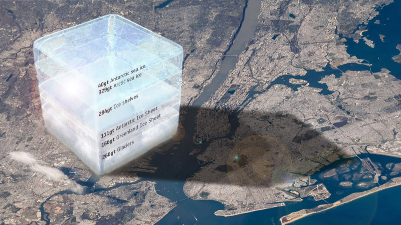
Computer graphic ice cube scaled to match an oblique photo of New York City taken from the International Space Station by NASA astronaut Jeffrey Williams in 2016. Graphics and compositing by Planetary Visions for the University of Leeds and the European Space Agency. (Planetary Visions/ESA/NASA)

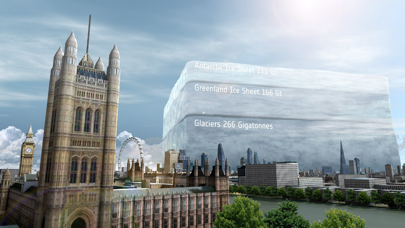
Annual global land ice loss towering over the London skyline, produced for the UN climate summit COP26, held in Glasgow in November 2021. (Planetary Visions/ESA)

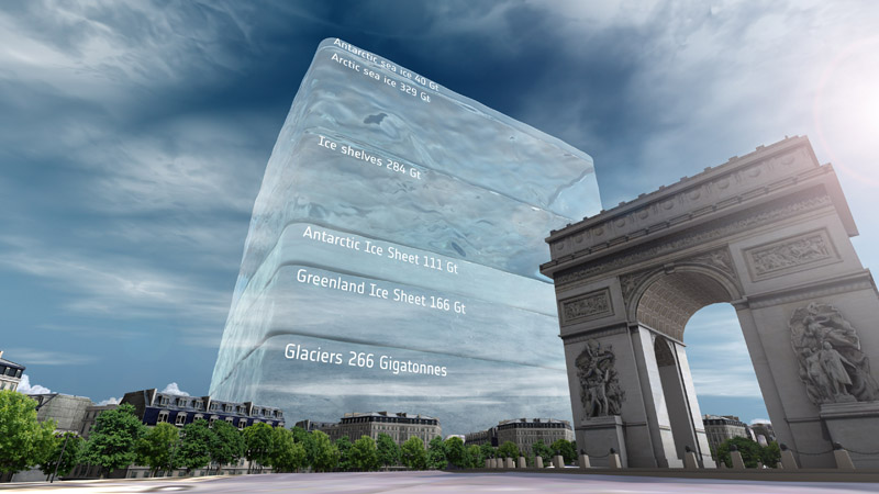
Paris landmarks are overshadowed by a giant ice cube representing Earth's annual ice loss for the International Astronautical Congress, held in the French capital in September 2022. (Planetary Visions/ESA)

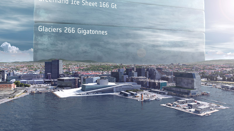
The buildings of Oslo's waterfront, including the Opera House and Munch Museum, are dwarfed by a 10km-wide ice cube representing the world's annual ice loss at the International Astronautical Federation's first Global Space Conference on Climate Change (GLOC), held in Oslo, May 2023. (Planetary Visions/ESA)
These data visualisations are based on science results from the UK's Centre for Polar Observation and Modelling, who used data from CryoSat and other ESA satellites to measure the ice lost from glaciers, ice shelves, ice sheets and sea ice since 1994.