In a series of computer-generated animations, Planetary Visions has been highlighting science results from the European Space Agency's ice mission, CryoSat.
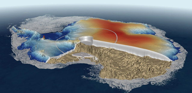
For the 2011 Paris Air Show we produced a visualisation showing the Antarctic ice cap using previous-best ice surface height data, then improved colour-coded height from Cryosat, and a slice through the ice cap to reveal bedrock depth and therefore ice thickness. Apart from the Cryosat data, all supporting terrain and image data was provided from our own resources.
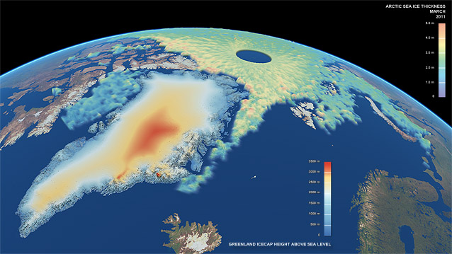
Similar maps of the Greenland ice cap and Arctic Ocean sea ice thickness were unveiled at the Royal Society in London in April 2012 as part of the celebration of 50 years of UK activity in space. CryoSat was conceived by scientists at the UK's Centre for Polar Observation and Monitoring. The new maps were derived from Cryosat's Radar Altimeter, with the ice cap terrain models generated by the University of Leeds, and the sea ice thickness maps by University College London.
image credits:
(top) CPOM / UCL / ESA / Planetary Visions
(bottom) CPOM / UCL / Univ of Leeds / ESA / Planetary Visions