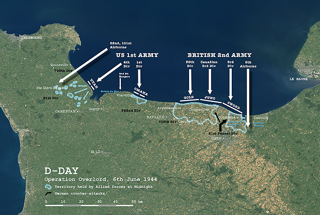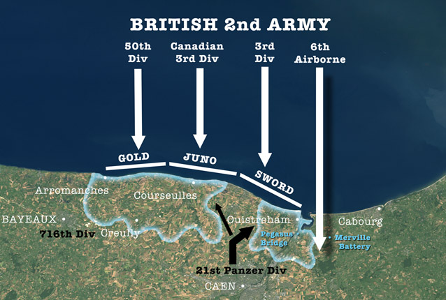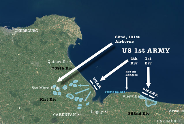
Map of the Normandy coastline showing the Allied units that launched the liberation of western Europe at the end of the Second World War. The natural-colour background is based on a mosaic of satellite images from Landsat 7.

In the east, British troops took Sword and Gold beaches, with a Canadian division landing on Juno. The first ground was taken by British paratroops, protecting the eastern flank by taking Pegasus Bridge and the German gun battery at Merville.

American troops landed on the western beaches Utah and Omaha, supported by airborne assaults to the west and a commando raid on the clifftop defences at Pointe du Hoc.
Satellite image mosaic and map Copyright © 2004 Planetary Visions Limited, based on data from Landsat 7 ETM+ and Terra MODIS (full size for print: 4950 x 3338 pixels)