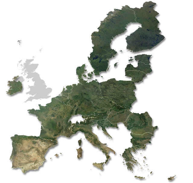
The political map of Europe is redrawn on 31 January 2020, when the United Kingdom leaves the European Union. The territories of the remaining 27 member countries are shown on our new maps of the post-Brexit EU. A combination of digital map data with cloud-free satellite images, these natural-colour image-maps are available at high resolution for large-format print use up to a scale of 1:1 million. These and similar images are available for licensed use in books, newspapers, magazines and tv, or as data layers in a GIS.
The Satellite Imagemap of Europe was jointly-developed by Planetary Visions and the German Aerospace Centre, DLR. Coastline and political boundary data was derived from the Digital Chart of the World and the US Navy's World Vector Shoreline.