Historical maps : the Aral Sea
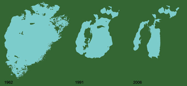
To chart the decline of the Aral Sea over 44 years, we used satellite imagery from the earliest days of the space programme. Declassified spy satellite images from the early 1960s were processed to chart the original shoreline for comparison with more recent images taken by civilian weather satellites.
Source data: KH-5, AVHRR and MODIS satellite imagery.