Political maps : European Union Enlargement 2004
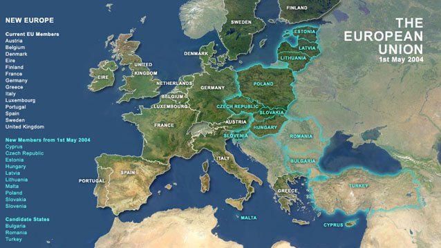
This map shows the countries that joined the European Union in 2004 and those negotiating for membership. Political boundaries are overlaid in different styles and a political mask is used to highlight the territory of the EU on the background
satellite image.
Source data: Digital Chart of the World, World Vector Shoreline,
Satellite Imagemap of Europe.