SERVICES
SERVICES
Home
|
Services
|
Animation
|
Texture maps
|
Terrain
|
Image Library
|
Portfolio
|
Contact us
3D graphics
Cartography
Political
Countries
EU enlargement
South East Asia
Gas Exploration
West Bank
Physical
Thematic
Historical
Astronomical
Projections
Satellite images
Consultancy
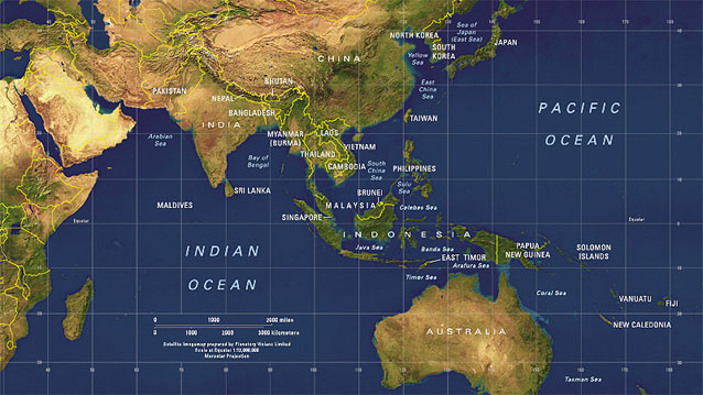
Political maps : South East Asia
This map of South East Asia overlays political boundaries, labels, graticule and scalebar on our cloud-free
Satellite Imagemap of the World
.
Source data:
Satellite Imagemap of the World
, Digital Chart of the World.